
Thank you for supporting this site ❤️
Make a donation
Make a donation
Gear up for your next adventure:
As an Amazon Associate, this site earns from qualifying purchases at no extra cost to you.
Govenlock topographic map
Click on the map to display elevation.
Thank you for supporting this site ❤️
Make a donation
Make a donation
Gear up for your next adventure:
As an Amazon Associate, this site earns from qualifying purchases at no extra cost to you.
About this map
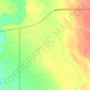
Name: Govenlock topographic map, elevation, terrain.
Location: Govenlock, Reno No. 51, Saskatchewan, Canada (49.21567 -109.81930 49.23567 -109.79930)
Average elevation: 3,058 ft
Minimum elevation: 2,986 ft
Maximum elevation: 3,097 ft
Thank you for supporting this site ❤️
Make a donation
Make a donation
Gear up for your next adventure:
As an Amazon Associate, this site earns from qualifying purchases at no extra cost to you.