
Make a donation
Gear up for your next adventure:
As an Amazon Associate, this site earns from qualifying purchases at no extra cost to you.
Glennallen topographic map
Click on the map to display elevation.
Make a donation
Gear up for your next adventure:
As an Amazon Associate, this site earns from qualifying purchases at no extra cost to you.
About this map
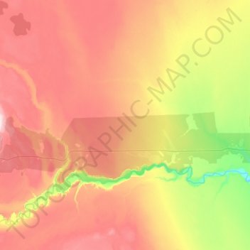
Name: Glennallen topographic map, elevation, terrain.
Location: Glennallen, Copper River, Alaska, United States (62.05934 -146.03202 62.21492 -145.39445)
Average elevation: 1,906 ft
Minimum elevation: 1,204 ft
Maximum elevation: 2,638 ft
Copper River trails, hiking, mountain biking, running and outdoor activities
Make a donation
Gear up for your next adventure:
As an Amazon Associate, this site earns from qualifying purchases at no extra cost to you.
Other topographic maps
Click on a map to view its topography, its elevation and its terrain.
Kennicott
United States > Alaska > Copper River
Topographic map showing the location of the Erie, Jumbo, Mother Lode, Bonanza and Glacier Mines in relation to Kennecott. Note the aerial tramways and haulage tunnels.
Average elevation: 2,589 ft