Geolocate

Santa Clara topographic map

Click on the map to display elevation.

About this map

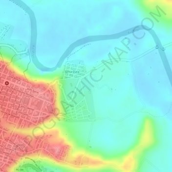
Name: Santa Clara topographic map, elevation, terrain.

Location: Santa Clara, Moyobamba, San Martín, Perú (-6.03706 -76.95970 -6.02191 -76.95066)

Average elevation: 2,707 ft

Minimum elevation: 2,612 ft

Maximum elevation: 2,907 ft

Other topographic maps

Click on a map to view its topography, its elevation and its terrain.

Playa Hermosa

Perú > San Martín > Moyobamba

Average elevation: 3,481 ft

Provincia de Moyobamba

Perú > San Martín > Moyobamba

Average elevation: 2,979 ft

Quillualpa

Perú > San Martín > Moyobamba

Average elevation: 3,711 ft

Tingana

Perú > San Martín > Moyobamba

Average elevation: 2,657 ft

Punta de San Juan

Perú > San Martín > Moyobamba

Average elevation: 2,746 ft

Parque Industrial

Perú > San Martín > Moyobamba > Parque Industrial

Average elevation: 2,822 ft

Gear up for your next adventure:

Backpacking Tents - Weight-optimized shelters for multi-day topographic surveys
🧢Sun Protection Hats - Wide-brimmed and UPF-rated hats for high-altitude sun safety
📻Weather Alert Radios - Stay informed of storm risks while off-the-grid
🔥Camping Stove - Portable stove for camping and backcountry cooking
🧥Men's Rain Shells - Premium waterproof and breathable jackets for mountain weather

As an Amazon Associate, this site earns from qualifying purchases at no extra cost to you.