
Rueter topographic map
Click on the map to display elevation.
About this map
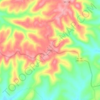
Name: Rueter topographic map, elevation, terrain.
Location: Rueter, Taney County, Missouri, 65744, United States (36.58840 -92.88906 36.62840 -92.84906)
Average elevation: 1,132 ft
Minimum elevation: 912 ft
Maximum elevation: 1,332 ft
Other topographic maps
Click on a map to view its topography, its elevation and its terrain.
Branson
United States > Missouri > Taney County
Branson features a diverse and picturesque topography characterized by rolling hills, deep valleys, and abundant water features. Nestled in the Ozark Mountains, the area has an elevation that typically ranges around 778 feet (237 meters) above sea level. The region is shaped by its proximity to several lakes,…
Average elevation: 902 ft
Taneyville
United States > Missouri > Taney County
Taneyville is located in north-central Taney County. The town lies along Missouri Route 76 between Bradleyville and Kissee Mills. The townsite is on a northeast–southwest trending ridge between Swan Creek to the northwest and Beaver Creek to the southeast. The site is at an elevation of 1,073 ft (327 m).
Average elevation: 1,024 ft
Silver Dollar City's WhiteWater
United States > Missouri > Taney County > Branson
Average elevation: 971 ft