
Make a donation
Gear up for your next adventure:
As an Amazon Associate, this site earns from qualifying purchases at no extra cost to you.
Knielingen topographic map
Click on the map to display elevation.
Make a donation
Gear up for your next adventure:
As an Amazon Associate, this site earns from qualifying purchases at no extra cost to you.
About this map
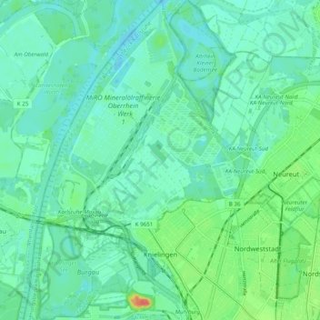
Name: Knielingen topographic map, elevation, terrain.
Location: Knielingen, Karlsruhe, Baden-Württemberg, 76187, Deutschland (49.01683 8.29944 49.08049 8.36833)
Average elevation: 351 ft
Minimum elevation: 308 ft
Maximum elevation: 499 ft
Make a donation
Gear up for your next adventure:
As an Amazon Associate, this site earns from qualifying purchases at no extra cost to you.
Other topographic maps
Click on a map to view its topography, its elevation and its terrain.
Maxau
Deutschland > Baden-Württemberg > Karlsruhe
Ein Denkmal für Johann Gottfried Tulla, den Initiator und Planer der Rheinbegradigung, steht bei Rheinkilometer 360,9 auf Höhe des Rheinabschnittes, an dem 1817 die Arbeiten begonnen wurden.
Average elevation: 348 ft
Make a donation
Gear up for your next adventure:
As an Amazon Associate, this site earns from qualifying purchases at no extra cost to you.