
Make a donation
Gear up for your next adventure:
As an Amazon Associate, this site earns from qualifying purchases at no extra cost to you.
Rappenwört topographic map
Click on the map to display elevation.
Make a donation
Gear up for your next adventure:
As an Amazon Associate, this site earns from qualifying purchases at no extra cost to you.
About this map
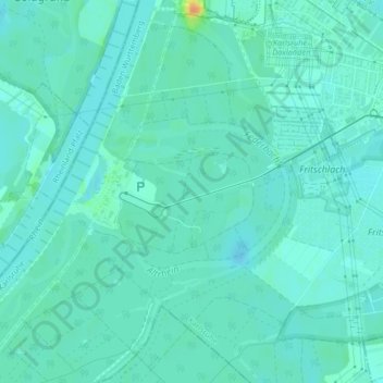
Name: Rappenwört topographic map, elevation, terrain.
Average elevation: 354 ft
Minimum elevation: 331 ft
Maximum elevation: 446 ft
Make a donation
Gear up for your next adventure:
As an Amazon Associate, this site earns from qualifying purchases at no extra cost to you.
Other topographic maps
Click on a map to view its topography, its elevation and its terrain.
Make a donation
Gear up for your next adventure:
As an Amazon Associate, this site earns from qualifying purchases at no extra cost to you.
Make a donation
Gear up for your next adventure:
As an Amazon Associate, this site earns from qualifying purchases at no extra cost to you.
Make a donation
Gear up for your next adventure:
As an Amazon Associate, this site earns from qualifying purchases at no extra cost to you.
Make a donation
Gear up for your next adventure:
As an Amazon Associate, this site earns from qualifying purchases at no extra cost to you.
Palmbach
Deutschland > Baden-Württemberg > Karlsruhe
Palmbach liegt naturräumlich im nördlichen Schwarzwald und gehört seit Januar 2021 zum Naturpark Schwarzwald Mitte/Nord. Es liegt direkt an der Autobahnausfahrt Karlsbad der A8 und zählt zu den Karlsruher Höhenstadtteilen, die in der Region „Bergdörfer“ genannt werden.
Average elevation: 856 ft