
Thank you for supporting this site ❤️
Make a donation
Make a donation
Gear up for your next adventure:
As an Amazon Associate, this site earns from qualifying purchases at no extra cost to you.
Sutherland topographic map
Click on the map to display elevation.
Thank you for supporting this site ❤️
Make a donation
Make a donation
Gear up for your next adventure:
As an Amazon Associate, this site earns from qualifying purchases at no extra cost to you.
About this map
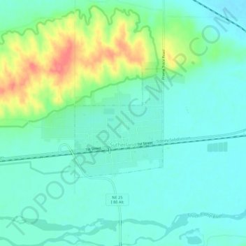
Name: Sutherland topographic map, elevation, terrain.
Location: Sutherland, Lincoln County, Nebraska, United States (41.15163 -101.13679 41.16961 -101.08300)
Average elevation: 2,986 ft
Minimum elevation: 2,927 ft
Maximum elevation: 3,143 ft
Lincoln County trails, hiking, mountain biking, running and outdoor activities
Thank you for supporting this site ❤️
Make a donation
Make a donation
Gear up for your next adventure:
As an Amazon Associate, this site earns from qualifying purchases at no extra cost to you.