
Make a donation
Gear up for your next adventure:
As an Amazon Associate, this site earns from qualifying purchases at no extra cost to you.
Mons Lake topographic map
Click on the map to display elevation.
Make a donation
Gear up for your next adventure:
As an Amazon Associate, this site earns from qualifying purchases at no extra cost to you.
About this map
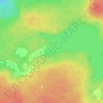
Name: Mons Lake topographic map, elevation, terrain.
Average elevation: 3,825 ft
Minimum elevation: 3,714 ft
Maximum elevation: 3,911 ft
Make a donation
Gear up for your next adventure:
As an Amazon Associate, this site earns from qualifying purchases at no extra cost to you.
Other topographic maps
Click on a map to view its topography, its elevation and its terrain.
Horse Lake
Canada > British Columbia > Cariboo Regional District > Area K (East Chilcotin)
Average elevation: 6,358 ft
Twan Lake
Canada > British Columbia > Cariboo Regional District > Area K (East Chilcotin)
Average elevation: 3,087 ft
Alexis Creek
Canada > British Columbia > Cariboo Regional District > Area K (East Chilcotin)
Average elevation: 2,671 ft
Big Creek
Canada > British Columbia > Cariboo Regional District > Area K (East Chilcotin)
Average elevation: 6,663 ft
Make a donation
Gear up for your next adventure:
As an Amazon Associate, this site earns from qualifying purchases at no extra cost to you.
Riske Creek
Canada > British Columbia > Cariboo Regional District > Area K (East Chilcotin)
Average elevation: 3,127 ft
Mount Vic
Canada > British Columbia > Cariboo Regional District > Area K (East Chilcotin)
Average elevation: 8,386 ft