
Fremont topographic map
Click on the map to display elevation.
Fremont
According to the United States Census Bureau, the city has a total area of 8.85 square miles (22.92 km2), of which 8.80 square miles (22.79 km2) is land and 0.05 square miles (0.13 km2) is water. Fremont lies in the river plain between the Platte and Elkhorn rivers, at an elevation of approximately 366 meters (1,203 ft) above sea level.
About this map
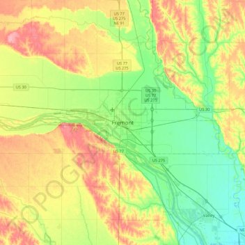
Name: Fremont topographic map, elevation, terrain.
Location: Fremont, Dodge County, Nebraska, 68025, United States (41.27384 -96.65604 41.59384 -96.33604)
Average elevation: 1,240 ft
Minimum elevation: 1,115 ft
Maximum elevation: 1,424 ft