Geolocate

Vega topographic map

Click on the map to display elevation.

About this map

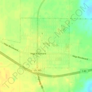
Name: Vega topographic map, elevation, terrain.

Location: Vega, Oldham County, Texas, 79092, United States (35.23698 -102.44155 35.25342 -102.41702)

Average elevation: 4,035 ft

Minimum elevation: 3,983 ft

Maximum elevation: 4,065 ft

Oldham County trails, hiking, mountain biking, running and outdoor activities

Other topographic maps

Click on a map to view its topography, its elevation and its terrain.

Vega

United States > Texas > Oldham County

Average elevation: 4,035 ft

Wildorado

United States > Texas > Oldham County

Average elevation: 3,927 ft

Gear up for your next adventure:

🎒Waterproof Dry Bags - Keep your electronics and maps dry inside your pack
📖Nature Tracking Books - Learn to track wildlife and terrain
🧼Biodegradable Camping Soap - Eco‑friendly soap for outdoor hygiene
👖Convertible Hiking Pants - Versatile zip-off pants for changing altitudes and temperatures
📦Dry Bags Set - Waterproof storage for electronics and clothes

As an Amazon Associate, this site earns from qualifying purchases at no extra cost to you.