
Make a donation
Gear up for your next adventure:
As an Amazon Associate, this site earns from qualifying purchases at no extra cost to you.
Bergkamen topographic map
Click on the map to display elevation.
Make a donation
Gear up for your next adventure:
As an Amazon Associate, this site earns from qualifying purchases at no extra cost to you.
Bergkamen
Höchste Erhebung im Stadtgebiet ist mit 148,5 m ü. NN die „Adener Höhe“ auf der künstlich aufgeschütteten Bergehalde Großes Holz, einer Landmarke im Ruhrgebiet.
Make a donation
Gear up for your next adventure:
As an Amazon Associate, this site earns from qualifying purchases at no extra cost to you.
About this map
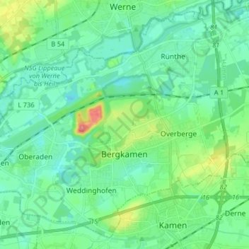
Name: Bergkamen topographic map, elevation, terrain.
Location: Bergkamen, Kreis Unna, Nordrhein-Westfalen, 59192, Deutschland (51.58774 7.56060 51.66109 7.69051)
Average elevation: 210 ft
Minimum elevation: 141 ft
Maximum elevation: 443 ft
Make a donation
Gear up for your next adventure:
As an Amazon Associate, this site earns from qualifying purchases at no extra cost to you.
Other topographic maps
Click on a map to view its topography, its elevation and its terrain.
Haar
Deutschland > Nordrhein-Westfalen > Kreis Unna
Die Haar (auch Haarstrang) ist ein Höhenzug am südlichen Rand der Westfälischen Bucht. Der Haarstrang erstreckt sich von West nach Ost im Süden der Stadt Dortmund sowie der Kreise Unna und Soest in Nordrhein-Westfalen. Naturräumlich stellt er den submontanen Südteil der Hellwegbörden dar, der nördlich…
Average elevation: 620 ft