Geolocate

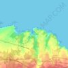
La Braña topographic map

Click on the map to display elevation.

About this map

Name: La Braña topographic map, elevation, terrain.

Location: La Braña, El Franco, Asturias, España (43.44913 -6.88958 43.50419 -6.83122)

Average elevation: 1,132 ft

Minimum elevation: 164 ft

Maximum elevation: 2,904 ft

Other topographic maps

Click on a map to view its topography, its elevation and its terrain.

Mernes

España > Asturias > El Franco

Average elevation: 125 ft

Viavélez

España > Asturias > El Franco > La Caridad

Average elevation: 89 ft

Gear up for your next adventure:

🛏️Cold Weather Sleeping Bag - Warm sleeping bag for cold conditions
🛌Ultralight Sleeping Bags - Compact down bags for cold nights in the wilderness
🧥Men's Rain Shells - Premium waterproof and breathable jackets for mountain weather
🪶Compact Camp Shovel - Folding shovel for campsite tasks
🧯Emergency Survival Kit - All‑in‑one survival essentials for the backcountry

As an Amazon Associate, this site earns from qualifying purchases at no extra cost to you.