Geolocate

Portishead topographic map

Click on the map to display elevation.

About this map
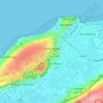
Name: Portishead topographic map, elevation, terrain.

Location: Portishead, North Somerset, England, United Kingdom (51.46364 -2.81890 51.49521 -2.74556)

Average elevation: 79 ft

Minimum elevation: 0 ft

Maximum elevation: 440 ft

Other topographic maps

Click on a map to view its topography, its elevation and its terrain.
Gear up for your next adventure:

👖Convertible Hiking Pants - Versatile zip-off pants for changing altitudes and temperatures
🧣Hiking Neck Gaiter - Multi‑use neck protection for outdoor weather
🧤Hiking Gloves - Protective gloves for rugged trails
🧭Map Reading Tools - Tools and kits for map navigation
☀️Outdoor Sunscreen - High protection sunscreen for outdoor activities

As an Amazon Associate, this site earns from qualifying purchases at no extra cost to you.