
Locking Parklands topographic map
Click on the map to display elevation.
About this map
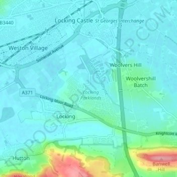
Name: Locking Parklands topographic map, elevation, terrain.
Average elevation: 75 ft
Minimum elevation: 3 ft
Maximum elevation: 446 ft
Other topographic maps
Click on a map to view its topography, its elevation and its terrain.
Gordano Valley
United Kingdom > England > North Somerset > Clapton-in-Gordano
Average elevation: 128 ft
Portishead Quays Marina
United Kingdom > England > North Somerset > Portishead > North Weston
Average elevation: 36 ft