
Thank you for supporting this site ❤️
Make a donation
Make a donation
Gear up for your next adventure:
As an Amazon Associate, this site earns from qualifying purchases at no extra cost to you.
Marsboro topographic map
Click on the map to display elevation.
Thank you for supporting this site ❤️
Make a donation
Make a donation
Gear up for your next adventure:
As an Amazon Associate, this site earns from qualifying purchases at no extra cost to you.
About this map
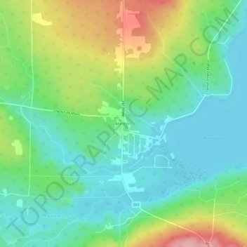
Name: Marsboro topographic map, elevation, terrain.
Location: Marsboro, Marston, Le Granit, Estrie, Quebec, Canada (45.53061 -70.96656 45.57061 -70.92656)
Average elevation: 1,447 ft
Minimum elevation: 1,293 ft
Maximum elevation: 1,768 ft
Thank you for supporting this site ❤️
Make a donation
Make a donation
Gear up for your next adventure:
As an Amazon Associate, this site earns from qualifying purchases at no extra cost to you.