
Make a donation
Gear up for your next adventure:
As an Amazon Associate, this site earns from qualifying purchases at no extra cost to you.
Mehlsack topographic map
Click on the map to display elevation.
Make a donation
Gear up for your next adventure:
As an Amazon Associate, this site earns from qualifying purchases at no extra cost to you.
About this map
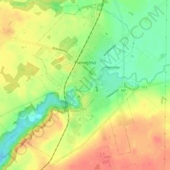
Name: Mehlsack topographic map, elevation, terrain.
Average elevation: 292 ft
Minimum elevation: 194 ft
Maximum elevation: 371 ft
Make a donation
Gear up for your next adventure:
As an Amazon Associate, this site earns from qualifying purchases at no extra cost to you.
Other topographic maps
Click on a map to view its topography, its elevation and its terrain.
Make a donation
Gear up for your next adventure:
As an Amazon Associate, this site earns from qualifying purchases at no extra cost to you.
Rehfeld
Polen > Woiwodschaft Ermland-Masuren > powiat braniewski
Übrige Ortschaften: Bemowizna (Böhmenhöfen) | Brzeszczyny (Schwillgarben) | Cielętnik (Kälberhaus) | Działy (Albertshof) | Elżbiecin (Lisettenhof) | Glinka (Hermannshof) | Goleszewo (Wilhelmshof) | Grodzie | Gronówko (Grunenfeld) | Grzędowo (Rödersdorf) | Józefowo (Josephsau) | Kalina (Kayling) |…
Average elevation: 243 ft
Make a donation
Gear up for your next adventure:
As an Amazon Associate, this site earns from qualifying purchases at no extra cost to you.