
Tre Cime di Lavaredo - Drei Zinnen topographic map
Interactive map
Click on the map to display elevation.
Tre Cime di Lavaredo - Drei Zinnen
Until 1919 the peaks formed part of the border between Italy and Austria-Hungary. Now they lie on the border between the Italian provinces of South Tyrol and Belluno and still are a part of the linguistic boundary between German-speaking and Italian-speaking majorities. The Cima Grande has an elevation of 2,999 metres (9,839 ft). It stands between the Cima Piccola, at 2,857 metres (9,373 ft), and the Cima Ovest, at 2,973 metres (9,754 ft).
About this map
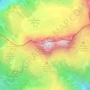
Name: Tre Cime di Lavaredo - Drei Zinnen topographic map, elevation, terrain.
Average elevation: 7,356 ft
Minimum elevation: 5,469 ft
Maximum elevation: 9,229 ft
Other topographic maps
Click on a map to view its topography, its elevation and its terrain.