Geolocate

Plummer topographic map

Click on the map to display elevation.

About this map
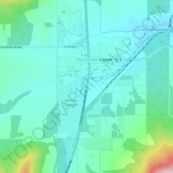
Name: Plummer topographic map, elevation, terrain.

Location: Plummer, Benewah County, Idaho, 83851, United States (47.31733 -116.89544 47.34449 -116.87461)

Average elevation: 2,802 ft

Minimum elevation: 2,638 ft

Maximum elevation: 3,517 ft

Benewah County trails, hiking, mountain biking, running and outdoor activities

Other topographic maps

Click on a map to view its topography, its elevation and its terrain.

Santa

United States > Idaho > Benewah County

Average elevation: 2,864 ft

Saint Joe Baldy

United States > Idaho > Benewah County

Average elevation: 4,593 ft

Fernwood

United States > Idaho > Benewah County

Average elevation: 2,894 ft

Gear up for your next adventure:

🛰️Handheld GPS Units - Professional satellite navigators for precise backcountry mapping
🏕️Family Camping Gear - Essentials for group camping trips
⛺Backpacking Tent - Lightweight and durable tent for multi‑day hikes
📱Solar Portable Charger - Solar power bank for charging devices off‑grid
🔭Telescopic Hiking Pole - Adjustable pole for hiking stability

As an Amazon Associate, this site earns from qualifying purchases at no extra cost to you.