Geolocate

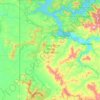
Santa topographic map

Click on the map to display elevation.

About this map

Name: Santa topographic map, elevation, terrain.

Location: Santa, Benewah County, Idaho, 83866, United States (47.13019 -116.46905 47.17019 -116.42905)

Average elevation: 2,864 ft

Minimum elevation: 2,602 ft

Maximum elevation: 3,494 ft

Other topographic maps

Click on a map to view its topography, its elevation and its terrain.
Plummer

United States > Idaho > Benewah County

Average elevation: 2,802 ft

Saint Maries

United States > Idaho > Benewah County

Average elevation: 2,260 ft

Saint Maries

United States > Idaho > Benewah County

Average elevation: 2,260 ft

Saint Maries

United States > Idaho > Benewah County

Average elevation: 2,260 ft

Plummer

United States > Idaho > Benewah County

Average elevation: 2,802 ft

Gear up for your next adventure:

🧭Compass with Lanyard - Easy‑carry compass for navigation
🪶Compact Camp Shovel - Folding shovel for campsite tasks
🎁Geography Themed Gifts - Unique gift ideas for map lovers and geography enthusiasts
🥇GPS Hiking Watch - Multi‑sport GPS watch with navigation and trail tracking
📚Navigation Handbooks - Master the art of reading topographic maps and using a compass

As an Amazon Associate, this site earns from qualifying purchases at no extra cost to you.