
Thank you for supporting this site ❤️
Make a donation
Make a donation
Gear up for your next adventure:
As an Amazon Associate, this site earns from qualifying purchases at no extra cost to you.
Lloydminster topographic map
Click on the map to display elevation.
Thank you for supporting this site ❤️
Make a donation
Make a donation
Gear up for your next adventure:
As an Amazon Associate, this site earns from qualifying purchases at no extra cost to you.
About this map
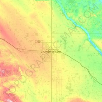
Name: Lloydminster topographic map, elevation, terrain.
Location: Lloydminster, Alberta, T9V 0C6, Canada (53.12000 -110.16885 53.44000 -109.84885)
Average elevation: 2,103 ft
Minimum elevation: 1,847 ft
Maximum elevation: 2,526 ft
Thank you for supporting this site ❤️
Make a donation
Make a donation
Gear up for your next adventure:
As an Amazon Associate, this site earns from qualifying purchases at no extra cost to you.