Geolocate

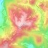
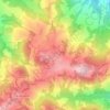
Palagano topographic map

Click on the map to display elevation.

About this map

Name: Palagano topographic map, elevation, terrain.

Location: Palagano, Unione dei comuni del Distretto Ceramico, Modena, Emilia-Romagna, 41046, Italy (44.24455 10.58437 44.40750 10.69748)

Average elevation: 2,654 ft

Minimum elevation: 902 ft

Maximum elevation: 5,194 ft

Other topographic maps

Click on a map to view its topography, its elevation and its terrain.
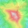
Monte Cimone

Italy > Emilia-Romagna > Modena > Fiumalbo

The mountain has an elevation of 2,165 m and is also the highest point in the Emilia-Romagna region of Italy.

Average elevation: 5,771 ft
Montombraro

Italy > Emilia-Romagna > Modena

Average elevation: 1,857 ft

Monte della Torraccia

Italy > Emilia-Romagna > Modena > Montese

Average elevation: 3,028 ft

Galleria

Italy > Emilia-Romagna > Modena > Campogalliano

Average elevation: 131 ft

Barigazzo

Italy > Emilia-Romagna > Modena

Average elevation: 3,839 ft

Pianorso

Italy > Emilia-Romagna > Modena

Average elevation: 2,776 ft

Villanova

Italy > Emilia-Romagna > Modena > Modena

Average elevation: 105 ft

Gear up for your next adventure:

⛺Backpacking Tents - Weight-optimized shelters for multi-day topographic surveys
🩳Quick‑Dry Hiking Shorts - Comfortable and quick‑dry shorts for summer hiking
👓Polarized Sunglasses - Outdoor sunglasses for glare reduction
🎒Day Hiking Backpack - Lightweight backpack perfect for day trips and outdoor adventures
🏔️Mountain Trail Maps - High‑detail maps for popular peaks

As an Amazon Associate, this site earns from qualifying purchases at no extra cost to you.