
Sutter Buttes topographic map
Click on the map to display elevation.
About this map
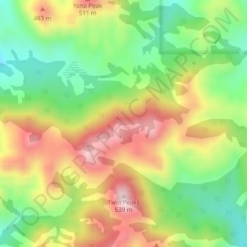
Name: Sutter Buttes topographic map, elevation, terrain.
Location: Sutter Buttes, Sutter County, California, United States (39.22170 -121.81771 39.22180 -121.81761)
Average elevation: 1,063 ft
Minimum elevation: 446 ft
Maximum elevation: 1,795 ft
Sutter County trails, hiking, mountain biking, running and outdoor activities
Other topographic maps
Click on a map to view its topography, its elevation and its terrain.
Yuba City
United States > California > Sutter County
On March 14, 1961, a Boeing B-52 Stratofortress carrying nuclear weapons, flying near Yuba City, encountered a pressurization problem, and had to drop to a lower altitude. Because of this, more fuel than expected was used, and the aircraft ran out of fuel. It crashed before meeting with a tanker aircraft. The…
Average elevation: 59 ft