Geolocate

Preston topographic map

Click on the map to display elevation.

About this map

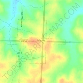
Name: Preston topographic map, elevation, terrain.

Location: Preston, Hickory County, Missouri, United States (37.93378 -93.22606 37.94813 -93.19875)

Average elevation: 1,020 ft

Minimum elevation: 958 ft

Maximum elevation: 1,079 ft

Hickory County trails, hiking, mountain biking, running and outdoor activities

Other topographic maps

Click on a map to view its topography, its elevation and its terrain.

White Cloud

United States > Missouri > Hickory County

Average elevation: 958 ft

Quincy

United States > Missouri > Hickory County

Average elevation: 951 ft

Avery

United States > Missouri > Hickory County

Average elevation: 814 ft

Elkton

United States > Missouri > Hickory County

Average elevation: 1,047 ft

Jordan

United States > Missouri > Hickory County

Average elevation: 909 ft

Nemo

United States > Missouri > Hickory County

Average elevation: 935 ft

Gear up for your next adventure:

🎒Trekking Poles - Sturdy poles for balance and stability on rough terrain
🦶Carbon Trekking Poles - Reduce knee impact on steep descents with ultra-light poles
🦟Ultrasonic Repellers - Create a bug-free zone at your camp or rest stop
🧢Outdoor Hiking Hat - Sun protection hat for outdoor explorers
🦺Reflective Outdoor Gear - Safety gear for low‑light conditions

As an Amazon Associate, this site earns from qualifying purchases at no extra cost to you.