
Thank you for supporting this site ❤️
Make a donation
Make a donation
Gear up for your next adventure:
As an Amazon Associate, this site earns from qualifying purchases at no extra cost to you.
Yoshkar-Ola topographic map
Click on the map to display elevation.
Thank you for supporting this site ❤️
Make a donation
Make a donation
Gear up for your next adventure:
As an Amazon Associate, this site earns from qualifying purchases at no extra cost to you.
About this map
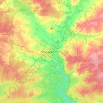
Name: Yoshkar-Ola topographic map, elevation, terrain.
Location: Yoshkar-Ola, Mari El, Volga Federal District, 424036, Russia (56.47282 47.73725 56.79282 48.05725)
Average elevation: 371 ft
Minimum elevation: 236 ft
Maximum elevation: 551 ft
Thank you for supporting this site ❤️
Make a donation
Make a donation
Gear up for your next adventure:
As an Amazon Associate, this site earns from qualifying purchases at no extra cost to you.