
虎牢关村 topographic map
Interactive map
Click on the map to display elevation.
About this map
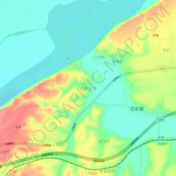
Name: 虎牢关村 topographic map, elevation, terrain.
Location: 虎牢关村, 郑州市, 河南省, 中国 (34.82998 113.17840 34.86998 113.21840)
Average elevation: 420 ft
Minimum elevation: 312 ft
Maximum elevation: 597 ft
Other topographic maps
Click on a map to view its topography, its elevation and its terrain.