
Tumco topographic map
Click on the map to display elevation.
Tumco
Hedges, later renamed Tumco, is a locale, a ghost town, site of a former mining town, in Imperial County, California. It lies at an elevation of 617 feet / 188 meters along the Tumco Wash in the Cargo Muchacho Mountains. Nearby is the Hedges Cemetery at an elevation of 643 feet (196 meters), at 32°53′04″N 114°49′52″W / 32.88444°N 114.83111°W / 32.88444; -114.83111.
About this map
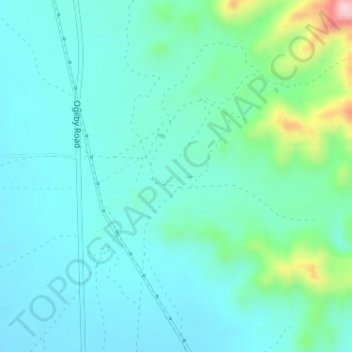
Name: Tumco topographic map, elevation, terrain.
Location: Tumco, Imperial County, California, United States (32.87127 -114.84032 32.89127 -114.82032)
Average elevation: 659 ft
Minimum elevation: 499 ft
Maximum elevation: 1,348 ft
Imperial County trails, hiking, mountain biking, running and outdoor activities
Other topographic maps
Click on a map to view its topography, its elevation and its terrain.
Brawley
United States > California > Imperial County
Brawley is located in the Colorado Desert and Lower Colorado River Valley regions. The city's elevation, like other Imperial Valley towns, is below sea level.
Average elevation: -118 ft
Calipatria
United States > California > Imperial County
At an elevation of 180 feet (55 m) below sea level, Calipatria is the lowest incorporated city in the Western Hemisphere. The city currently claims to have the "tallest flagpole (184 feet) where the flag flies at sea level" at 184 feet (56 m), so their American flag will always fly above sea level. According…
Average elevation: -164 ft
Bombay Beach
United States > California > Imperial County
The derelict "living ghost town" status of Bombay Beach has attracted many photographers, filmmakers, urban explorers, and tourists. The town, as well as others on the shores of the Salton Sea, is one of the lowest settlements in elevation in North America. The local American Legion, Post 801, had 36 members…
Average elevation: -200 ft
Calipatria
United States > California > Imperial County
At an elevation of 180 feet (55 m) below sea level, Calipatria is the lowest incorporated city in the Western Hemisphere. The city currently claims to have the "tallest flagpole (184 feet) where the flag flies at sea level" at 184 feet (56 m), so their American flag will always fly above sea level. According…
Average elevation: -174 ft