
Make a donation
Gear up for your next adventure:
As an Amazon Associate, this site earns from qualifying purchases at no extra cost to you.
Arun River topographic map
Click on the map to display elevation.
Make a donation
Gear up for your next adventure:
As an Amazon Associate, this site earns from qualifying purchases at no extra cost to you.
Arun River
The Tibetan name Bum-chu may refer to a religious ceremony attempting to divine prospects for the coming year from the level of water in a pot or well, chu is the Tibetan word for water. The river originates near Gutso in Nyalam County of Tibet. Around 17 kilometres (11 mi) downstream, the Men-chu joins it. The Tingri county occupies the upper reaches of the Bum-chu and the lateral valleys formed by its tributaries, the foremost of which are Lolo-chu, Shel-chu, Rongpu-chu, Trakar-chu, Kharda-chu, Ra-chu Tsangpo, and Langkor Gya-chu. The Yeru Tsanpo converges with Bum-chu in Tingkye County, which accommodates the lower Bum-chu valley. Another river that meets Bum-chu is Trakar-chu. The river flows past the town of Kharda, gateway to the Khangzhung east face of Everest. The force of its accumulated waters carves its way, south of Drengtrang, through the main chain of the Himalayas directly between the mountain massifs of Makalu and Kangchenjunga into Nepal. Since the river's elevation is about 3,500 metres (11,500 ft) at the border, while Makalu and Kangchenjunga are both about 8,500 metres (27,900 ft), the valley is some 5,000 metres (16,000 ft) deep, one of the world's deepest.
Make a donation
Gear up for your next adventure:
As an Amazon Associate, this site earns from qualifying purchases at no extra cost to you.
About this map
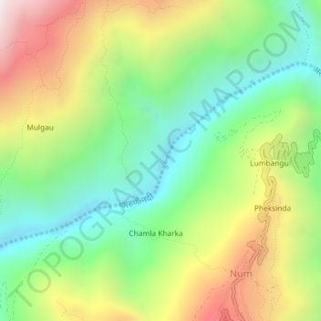
Name: Arun River topographic map, elevation, terrain.
Average elevation: 3,783 ft
Minimum elevation: 2,277 ft
Maximum elevation: 6,027 ft
Make a donation
Gear up for your next adventure:
As an Amazon Associate, this site earns from qualifying purchases at no extra cost to you.