
西溪南村 topographic map
Interactive map
Click on the map to display elevation.
About this map
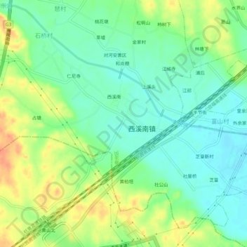
Name: 西溪南村 topographic map, elevation, terrain.
Location: 西溪南村, 黄山市, 安徽省, 中国 (29.81450 118.26139 29.85450 118.30139)
Average elevation: 476 ft
Minimum elevation: 420 ft
Maximum elevation: 558 ft
Other topographic maps
Click on a map to view its topography, its elevation and its terrain.