Geolocate
👉 Easily get elevation data in JSON, GeoTIFF and KML formats using Elevation API
Thank you for supporting this site ❤️
Make a donation

Three Forks topographic map

Click on the map to display elevation.

About this map

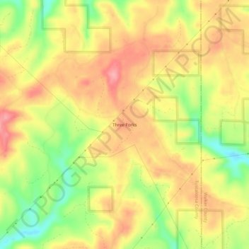
Name: Three Forks topographic map, elevation, terrain.

Location: Three Forks, Tuscaloosa County, Alabama, United States (33.53344 -87.35306 33.57344 -87.31306)

Average elevation: 512 ft

Minimum elevation: 302 ft

Maximum elevation: 666 ft

Tuscaloosa County trails, hiking, mountain biking, running and outdoor activities

Other topographic maps

Click on a map to view its topography, its elevation and its terrain.

Holt

United States > Alabama > Tuscaloosa County > Elm Ridge

Average elevation: 289 ft

Northport

United States > Alabama > Tuscaloosa County > Northport

Average elevation: 292 ft

Northport

United States > Alabama > Tuscaloosa County > Northport

Average elevation: 282 ft

Lake View

United States > Alabama > Tuscaloosa County

Average elevation: 571 ft

Brookwood

United States > Alabama > Tuscaloosa County

Average elevation: 492 ft

Coaling

United States > Alabama > Tuscaloosa County

Average elevation: 427 ft

Coker

United States > Alabama > Tuscaloosa County

Average elevation: 223 ft

Gear up for your next adventure:

🪓Survival Multi‑Tool - Versatile tool for camp and trail tasks
🧺Microfiber Travel Towels - Compact and fast-drying towels for trail use
🧭Orienteering Set - Complete compass and map reading kit
🌡️Handheld Weather Meters - Measure wind, temp, and pressure for safe mountain travel
🪑Ultralight Camp Chairs - Portable seating for resting after a long day of mapping

As an Amazon Associate, this site earns from qualifying purchases at no extra cost to you.