Geolocate

French Village topographic map

Click on the map to display elevation.

About this map
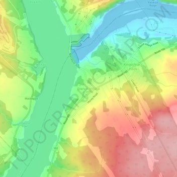
Name: French Village topographic map, elevation, terrain.

Location: French Village, Lower Kingsclear, Kingsclear Parish, Hanwell Rural Community, York County, New Brunswick, E3E 1K3, Canada (45.92374 -66.88557 45.96374 -66.84557)

Average elevation: 230 ft

Minimum elevation: -46 ft

Maximum elevation: 518 ft

Other topographic maps

Click on a map to view its topography, its elevation and its terrain.

Gear up for your next adventure:

🧣Hiking Neck Gaiter - Multi‑use neck protection for outdoor weather
🥘Titanium Cookware - Durable, featherlight pots and pans for backpacking
🪶Paracord Bracelet - Survival bracelet with built‑in tools
🕶️GPS Smartphone Mount - Secure mount for phone navigation
🔌Solar Panel Charger - Charge gear sustainably outdoors

As an Amazon Associate, this site earns from qualifying purchases at no extra cost to you.