
England topographic map
Click on the map to display elevation.
About this map
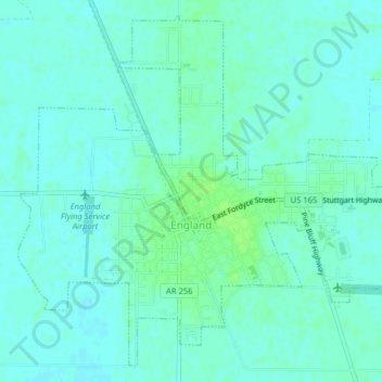
Name: England topographic map, elevation, terrain.
Location: England, Lonoke County, Arkansas, United States (34.53213 -91.98708 34.56217 -91.94732)
Average elevation: 230 ft
Minimum elevation: 217 ft
Maximum elevation: 249 ft
Lonoke County trails, hiking, mountain biking, running and outdoor activities
Other topographic maps
Click on a map to view its topography, its elevation and its terrain.