Geolocate

Furlow topographic map

Click on the map to display elevation.

About this map

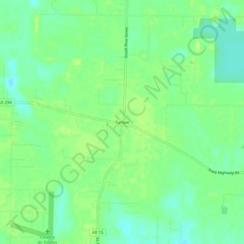
Name: Furlow topographic map, elevation, terrain.

Location: Furlow, Lonoke County, Arkansas, United States (34.81315 -92.00042 34.85315 -91.96042)

Average elevation: 259 ft

Minimum elevation: 230 ft

Maximum elevation: 279 ft

Lonoke County trails, hiking, mountain biking, running and outdoor activities

Other topographic maps

Click on a map to view its topography, its elevation and its terrain.

Keo

United States > Arkansas > Lonoke County

Average elevation: 233 ft

Humnoke

United States > Arkansas > Lonoke County

Average elevation: 203 ft

Carlisle

United States > Arkansas > Lonoke County

Average elevation: 236 ft

England

United States > Arkansas > Lonoke County

Average elevation: 230 ft

Coy

United States > Arkansas > Lonoke County

Average elevation: 217 ft

Allport

United States > Arkansas > Lonoke County

Average elevation: 203 ft

Ward

United States > Arkansas > Lonoke County

Average elevation: 249 ft

Gear up for your next adventure:

🪑Portable Camp Table - Compact table for campsite meals
🧭Pro Hiking Compasses - High-accuracy liquid-filled compasses for topographic orientation
🪶Survival Guide Book - Expert advice for emergency preparedness
🧢Sun Protection Hats - Wide-brimmed and UPF-rated hats for high-altitude sun safety
🪶Fire Starter Kit - Reliable fire starter for survival and camping

As an Amazon Associate, this site earns from qualifying purchases at no extra cost to you.