Geolocate

Rossburg topographic map

Click on the map to display elevation.

About this map

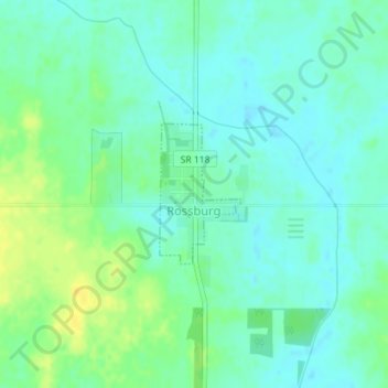
Name: Rossburg topographic map, elevation, terrain.

Location: Rossburg, Darke County, Ohio, United States (40.27520 -84.64057 40.28500 -84.63318)

Average elevation: 1,040 ft

Minimum elevation: 1,014 ft

Maximum elevation: 1,086 ft

Darke County trails, hiking, mountain biking, running and outdoor activities

Other topographic maps

Click on a map to view its topography, its elevation and its terrain.

Union Corners

United States > Ohio > Darke County

Average elevation: 1,010 ft

Webster

United States > Ohio > Darke County

Average elevation: 991 ft

Horatio

United States > Ohio > Darke County

Average elevation: 1,010 ft

Abbottsville

United States > Ohio > Darke County

Average elevation: 1,050 ft

Hill Grove

United States > Ohio > Darke County

Average elevation: 1,073 ft

Delisle

United States > Ohio > Darke County

Average elevation: 1,053 ft

Gear up for your next adventure:

💧Water Filtration Bottles - Safely drink from streams and lakes while exploring
🪶Compact Camp Shovel - Folding shovel for campsite tasks
🛠️Outdoor Gear Repair Kit - Essential tools to fix gear on the trail
🎒Outdoor Daypacks - Lightweight backpacks designed for carrying maps and essential gear
😴Insulated Sleeping Pads - Compact and warm pads for high-elevation camping

As an Amazon Associate, this site earns from qualifying purchases at no extra cost to you.