Geolocate

Yorkshire topographic map

Click on the map to display elevation.

About this map

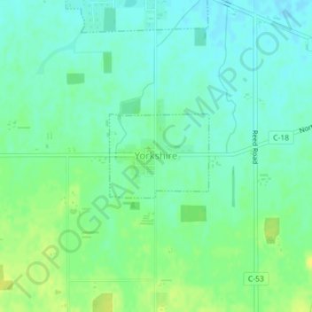
Name: Yorkshire topographic map, elevation, terrain.

Location: Yorkshire, Darke County, Ohio, United States (40.32154 -84.50060 40.32883 -84.48928)

Average elevation: 981 ft

Minimum elevation: 955 ft

Maximum elevation: 1,017 ft

Darke County trails, hiking, mountain biking, running and outdoor activities

Other topographic maps

Click on a map to view its topography, its elevation and its terrain.

Union Corners

United States > Ohio > Darke County

Average elevation: 1,010 ft

Webster

United States > Ohio > Darke County

Average elevation: 991 ft

Horatio

United States > Ohio > Darke County

Average elevation: 1,010 ft

Abbottsville

United States > Ohio > Darke County

Average elevation: 1,050 ft

Hill Grove

United States > Ohio > Darke County

Average elevation: 1,073 ft

Delisle

United States > Ohio > Darke County

Average elevation: 1,053 ft

Gear up for your next adventure:

🔋Rechargeable Batteries - Power up your outdoor devices
🧦Hiking Socks - Comfortable socks to prevent blisters on long hikes
📦Dry Bags Set - Waterproof storage for electronics and clothes
🎒Outdoor Daypacks - Lightweight backpacks designed for carrying maps and essential gear
🌎3D Topographic Globes - Raised relief globes for a tactile understanding of geography

As an Amazon Associate, this site earns from qualifying purchases at no extra cost to you.