
华阳镇 topographic map
Interactive map
Click on the map to display elevation.
About this map
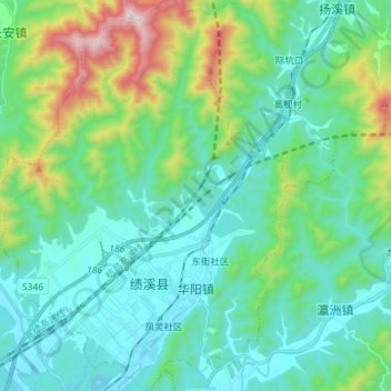
Name: 华阳镇 topographic map, elevation, terrain.
Location: 华阳镇, 绩溪县, 宣城市, 安徽省, 245300, 中国 (30.03546 118.51778 30.15842 118.62526)
Average elevation: 1,135 ft
Minimum elevation: 482 ft
Maximum elevation: 3,540 ft
Other topographic maps
Click on a map to view its topography, its elevation and its terrain.