
伏岭镇 topographic map
Interactive map
Click on the map to display elevation.
About this map
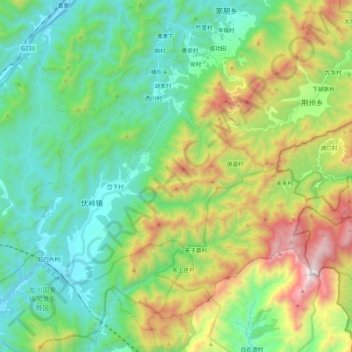
Name: 伏岭镇 topographic map, elevation, terrain.
Location: 伏岭镇, 绩溪县, 宣城市, 安徽省, 中国 (30.06373 118.68119 30.24155 118.89478)
Average elevation: 2,152 ft
Minimum elevation: 610 ft
Maximum elevation: 5,781 ft
Other topographic maps
Click on a map to view its topography, its elevation and its terrain.