
Elbow Lake topographic map
Click on the map to display elevation.
About this map
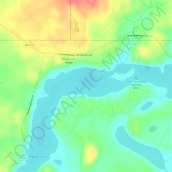
Name: Elbow Lake topographic map, elevation, terrain.
Location: Elbow Lake, Becker County, Minnesota, United States (47.12915 -95.56780 47.15254 -95.50972)
Average elevation: 1,568 ft
Minimum elevation: 1,490 ft
Maximum elevation: 1,709 ft
Becker County trails, hiking, mountain biking, running and outdoor activities
Other topographic maps
Click on a map to view its topography, its elevation and its terrain.
Detroit Lakes
United States > Minnesota > Becker County > Detroit Lakes > Detroit Lakes
Average elevation: 1,362 ft