Geolocate

Berlin topographic map

Click on the map to display elevation.

About this map

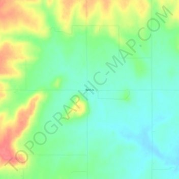
Name: Berlin topographic map, elevation, terrain.

Location: Berlin, Bourbon County, Kansas, United States (37.90143 -94.91608 37.94143 -94.87608)

Average elevation: 961 ft

Minimum elevation: 879 ft

Maximum elevation: 1,102 ft

Bourbon County trails, hiking, mountain biking, running and outdoor activities

Other topographic maps

Click on a map to view its topography, its elevation and its terrain.

Fort Scott

United States > Kansas > Bourbon County

Average elevation: 873 ft

Gear up for your next adventure:

🩹Survival Bandages - High‑quality bandages for emergencies
🪶Thermal Camp Blanket - Extra warmth for cold nights
🪶Compact Camp Shovel - Folding shovel for campsite tasks
🌐World Map Poster - Decorative world maps with topographic info
🛰️Handheld GPS Units - Professional satellite navigators for precise backcountry mapping

As an Amazon Associate, this site earns from qualifying purchases at no extra cost to you.