Geolocate

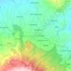
Modopuro topographic map

Click on the map to display elevation.

About this map

Name: Modopuro topographic map, elevation, terrain.

Location: Modopuro, Mojokerto, East Java, Indonesia (-7.50632 112.52269 -7.48033 112.53890)

Average elevation: 59 ft

Minimum elevation: 26 ft

Maximum elevation: 92 ft

Other topographic maps

Click on a map to view its topography, its elevation and its terrain.

Gunung Anjasmoro

Indonesia > East Java > Mojokerto > Gumeng

Average elevation: 6,253 ft

Gunung Pundak

Indonesia > East Java > Mojokerto > Claket

Average elevation: 4,511 ft

Puncak Cendono

Indonesia > East Java > Mojokerto > Gumeng

Average elevation: 3,051 ft

Trawas

Indonesia > East Java > Mojokerto

Average elevation: 2,661 ft

Puthuk Gragal

Indonesia > East Java > Mojokerto > Claket

Average elevation: 4,606 ft

Mount Penanggungan

Indonesia > East Java > Mojokerto > Kedungudi

There are sub-peaks around Penanggungan, starting to the southeast from Mount Wangi (Gunung Wangi) at 970 meters above sea level, Mount Bekel Jolotundo elevated 1,200 meters ASL, a semi-freestanding peak to the northwest; Puncak Kemuncup rising to 1,200 meters on the eastern face, Puncak Sarah Klopo on the…

Average elevation: 3,481 ft
Tretes

Indonesia > East Java > Mojokerto

Average elevation: 2,621 ft

Jatirejo

Indonesia > East Java > Mojokerto > Gading

Average elevation: 269 ft

Trowulan

Indonesia > East Java > Mojokerto > Jambuwok

Average elevation: 135 ft

Brantas

Indonesia > East Java > Mojokerto > Mlirip

Average elevation: 79 ft

Duyung

Indonesia > East Java > Mojokerto

Average elevation: 2,051 ft

Mount Penanggungan

Indonesia > East Java > Mojokerto > Kedungudi

There are sub-peaks around Penanggungan, starting to the southeast from Mount Wangi (Gunung Wangi) at 970 meters above sea level, Mount Bekel Jolotundo elevated 1,200 meters ASL, a semi-freestanding peak to the northwest; Puncak Kemuncup rising to 1,200 meters on the eastern face, Puncak Sarah Klopo on the…

Average elevation: 3,481 ft
Seloliman

Indonesia > East Java > Mojokerto

Average elevation: 1,322 ft

Gear up for your next adventure:

🏥Hiking First Aid Kits - Comprehensive medical kits for remote trail injuries
🔥Fast-Boil Camping Stoves - Efficient cooking systems for quick trail meals
🧢Sun Protection Hats - Wide-brimmed and UPF-rated hats for high-altitude sun safety
😴Insulated Sleeping Pads - Compact and warm pads for high-elevation camping
🪶Wildlife Field Guides - Learn animal tracking and species ID

As an Amazon Associate, this site earns from qualifying purchases at no extra cost to you.