Geolocate

Phantom Terrace topographic map

Click on the map to display elevation.

About this map

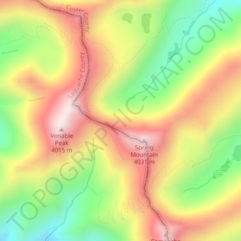
Name: Phantom Terrace topographic map, elevation, terrain.

Location: Phantom Terrace, Custer County, Colorado, United States (38.05551 -105.62145 38.05561 -105.62135)

Average elevation: 12,228 ft

Minimum elevation: 11,125 ft

Maximum elevation: 13,278 ft

Custer County trails, hiking, mountain biking, running and outdoor activities

Other topographic maps

Click on a map to view its topography, its elevation and its terrain.

Westcliffe

United States > Colorado > Custer County

Average elevation: 7,887 ft

Silver Cliff

United States > Colorado > Custer County

Average elevation: 8,054 ft

Gear up for your next adventure:

🥾Hiking Shoes - Durable and comfortable shoes for trail hiking
🖼️Topo Map Wall Art - Decorative topographic prints of famous peaks and regions
🎒Trekking Poles - Sturdy poles for balance and stability on rough terrain
🥩Freeze-Dried Meals - Nutritious and lightweight food for remote expeditions
🏫Relief Map Kits - Hands-on tools for teaching landforms and elevation

As an Amazon Associate, this site earns from qualifying purchases at no extra cost to you.