Geolocate

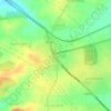
Marohalli topographic map

Click on the map to display elevation.

About this map

Name: Marohalli topographic map, elevation, terrain.

Location: Marohalli, Nelamangala taluk, Bengaluru North, Karnataka, India (13.14968 77.33446 13.15562 77.34645)

Average elevation: 2,858 ft

Minimum elevation: 2,802 ft

Maximum elevation: 2,933 ft

Other topographic maps

Click on a map to view its topography, its elevation and its terrain.
Nelamangala

India > Karnataka > Nelamangala taluk

{{Infobox settlement | name = Nelamangala | native_name = ನೆಲಮಂಗಲ | native_name_lang = kn | other_name = | nickname = | settlement_type = City | image_skyline = | image_alt = | image_caption = | pushpin_map = India Karnataka#India#Asia | pushpin_label_position = right | pushpin_map_alt = |…

Average elevation: 2,900 ft
Lakkenahalli

India > Karnataka > Nelamangala taluk

Average elevation: 2,930 ft

Dabaspete

India > Karnataka > Nelamangala taluk

Average elevation: 3,041 ft

Tyagadahalli

India > Karnataka > Nelamangala taluk

Average elevation: 2,976 ft

Gear up for your next adventure:

📻Weather Alert Radios - Stay informed of storm risks while off-the-grid
🦶Carbon Trekking Poles - Reduce knee impact on steep descents with ultra-light poles
🩳Quick‑Dry Hiking Shorts - Comfortable and quick‑dry shorts for summer hiking
❄️Traction Cleats - Prevent slips on icy trails during winter hikes
📱Heavy-Duty Phone Cases - Drop-proof and waterproof protection for outdoor navigation

As an Amazon Associate, this site earns from qualifying purchases at no extra cost to you.