Geolocate

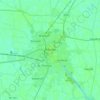
Kirton CP topographic map

Click on the map to display elevation.

About this map

Name: Kirton CP topographic map, elevation, terrain.

Location: Kirton CP, Boston, Lincolnshire, Greater Lincolnshire, England, United Kingdom (52.89333 -0.14492 52.97639 0.06453)

Average elevation: 13 ft

Minimum elevation: 0 ft

Maximum elevation: 26 ft

Other topographic maps

Click on a map to view its topography, its elevation and its terrain.
Benington

United Kingdom > England > Lincolnshire > Boston

Average elevation: 13 ft

Boston

United Kingdom > England > Lincolnshire > Boston > Boston

Average elevation: 13 ft

Sutterton

United Kingdom > England > Lincolnshire > Boston

Average elevation: 13 ft

Fishtoft

United Kingdom > England > Lincolnshire > Boston

Average elevation: 13 ft

Gear up for your next adventure:

🪶Camp Gear Gift Set - Perfect gift bundle for outdoor fans
🥇GPS Hiking Watch - Multi‑sport GPS watch with navigation and trail tracking
🪶Paracord Bracelet - Survival bracelet with built‑in tools
📚USA Hiking Guide Books - Top trail guides and map books
🦶Carbon Trekking Poles - Reduce knee impact on steep descents with ultra-light poles

As an Amazon Associate, this site earns from qualifying purchases at no extra cost to you.