
Make a donation
Gear up for your next adventure:
As an Amazon Associate, this site earns from qualifying purchases at no extra cost to you.
Grundschöttel topographic map
Click on the map to display elevation.
Make a donation
Gear up for your next adventure:
As an Amazon Associate, this site earns from qualifying purchases at no extra cost to you.
About this map
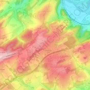
Name: Grundschöttel topographic map, elevation, terrain.
Average elevation: 630 ft
Minimum elevation: 256 ft
Maximum elevation: 876 ft
Make a donation
Gear up for your next adventure:
As an Amazon Associate, this site earns from qualifying purchases at no extra cost to you.
Other topographic maps
Click on a map to view its topography, its elevation and its terrain.
Voßhöfen
Deutschland > Nordrhein-Westfalen > Ennepe-Ruhr-Kreis > Wetter (Ruhr)
Average elevation: 568 ft
Harkortturm
Deutschland > Nordrhein-Westfalen > Ennepe-Ruhr-Kreis > Wetter (Ruhr)
Aus einem 1882 durchgeführten Architektenwettbewerb ging der gemeinsame Entwurf der Düsseldorfer Architekten Otto van Els und Bruno Schmitz siegreich hervor. Nachdem die Architekten einige Änderungswünsche der Bauherrschaft eingearbeitet hatten, ergab sich ein Kostenvoranschlag in Höhe von 20.000 Mark –…
Average elevation: 463 ft
Albringhausen
Deutschland > Nordrhein-Westfalen > Ennepe-Ruhr-Kreis > Wetter (Ruhr)
Average elevation: 663 ft