Geolocate

Jeddo topographic map

Click on the map to display elevation.

About this map

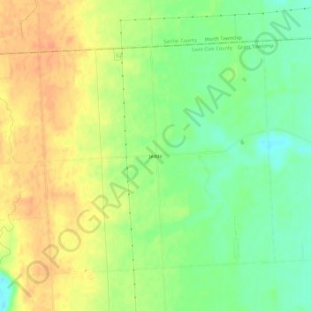
Name: Jeddo topographic map, elevation, terrain.

Location: Jeddo, Saint Clair County, Michigan, 48032, United States (43.13186 -82.60358 43.17186 -82.56358)

Average elevation: 728 ft

Minimum elevation: 656 ft

Maximum elevation: 794 ft

Other topographic maps

Click on a map to view its topography, its elevation and its terrain.

Port Huron

United States > Michigan > Saint Clair County

Average elevation: 607 ft

Marysville

United States > Michigan > Saint Clair County

Average elevation: 620 ft

Capac

United States > Michigan > Saint Clair County

Average elevation: 804 ft

Port Huron

United States > Michigan > Saint Clair County

Average elevation: 607 ft

Gear up for your next adventure:

📚USA Hiking Guide Books - Top trail guides and map books
🚑Emergency Bivvies - Heat-reflective sleeping bags for survival situations
🩹Survival Bandages - High‑quality bandages for emergencies
🧦Merino Wool Socks - Moisture-wicking, blister-preventing socks for long treks
🍳Camping Cook Set - Complete cookware for outdoor meals

As an Amazon Associate, this site earns from qualifying purchases at no extra cost to you.