New Braunfels topographic map
Click on the map to display elevation.
New Braunfels
New Braunfels occupies a transitional Hill Country setting on the Balcones Escarpment, where the higher, more dissected limestone uplands of the Edwards Plateau give way southeastward toward lower prairie terrain. The city’s relief is organized around the Guadalupe River valley and the short spring-fed Comal River, whose confluence lies within the urban area, creating a low central corridor framed by rising slopes, benches, and rounded hills to the north and west. Elevations in and around the city generally step down from the rugged uplands near State Highway 46 toward the flatter river bottoms and gently rolling southeastern outskirts, with the provided terrain view showing a broad range from about 528 to 1,240 feet (161 to 378 meters). This contrast reflects the local influence of the Balcones Fault Zone and Edwards Aquifer springs, which help shape the landscape through fault-controlled spring outlets, limestone valleys, and flood-prone river corridors, giving New Braunfels a physical character that blends steep-edged Hill Country relief with open, lower-gradient plains.
About this map
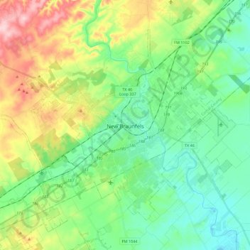
Name: New Braunfels topographic map, elevation, terrain.
Location: New Braunfels, Comal County, Texas, United States (29.63052 -98.24818 29.77698 -98.02766)
Average elevation: 748 ft
Minimum elevation: 538 ft
Maximum elevation: 1,207 ft
Comal County trails, hiking, mountain biking, running and outdoor activities
Other topographic maps
Click on a map to view its topography, its elevation and its terrain.



Guadalupe River State Park
United States > Texas > Comal County > Spring Branch
Average elevation: 1,158 ft
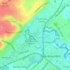
Comal River
United States > Texas > Comal County > New Braunfels > Landa Park Estates
Average elevation: 676 ft