Geolocate

Terrusso topographic map

Click on the map to display elevation.

About this map

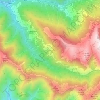
Name: Terrusso topographic map, elevation, terrain.

Location: Terrusso, Bargagli, Genoa, Liguria, 16021, Italy (44.40236 9.05297 44.44236 9.09297)

Average elevation: 1,791 ft

Minimum elevation: 512 ft

Maximum elevation: 3,156 ft

Gear up for your next adventure:

🔥Fast-Boil Camping Stoves - Efficient cooking systems for quick trail meals
🧢Outdoor Hiking Hat - Sun protection hat for outdoor explorers
🎒Trekking Poles - Sturdy poles for balance and stability on rough terrain
🪄Magnetic Compass - Accurate compass for navigation
🧭Hiking Compass - Precision compass for reliable navigation in the wilderness

As an Amazon Associate, this site earns from qualifying purchases at no extra cost to you.