Geolocate

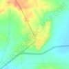
Rapar topographic map

Click on the map to display elevation.

Rapar

Rapar (earlier known as Rahpar) is located at 23°34′N 70°38′E / 23.57°N 70.63°E / 23.57; 70.63. It has an average elevation of 79 metres (259 feet). Rapar is the main town in the Vagad Region of the Kutch District and the easternmost town of the Kutch District.

Wikipedia (CC-BY-SA 3.0)

About this map

Name: Rapar topographic map, elevation, terrain.

Location: Rapar, Rapar Taluka, Kachchh, Gujarat, 370165, India (23.53075 70.60505 23.61075 70.68505)

Average elevation: 230 ft

Minimum elevation: 115 ft

Maximum elevation: 410 ft

Other topographic maps

Click on a map to view its topography, its elevation and its terrain.
Rapar

India > Gujarat > Rapar Taluka

Average elevation: 217 ft

Chitrod

India > Gujarat > Rapar Taluka

Average elevation: 361 ft

Gear up for your next adventure:

📚Navigation Handbooks - Master the art of reading topographic maps and using a compass
📶Vehicle Signal Boosters - Improve reception in rural areas while driving to trailheads
🧭Outdoor Navigation Book - Learn advanced navigation skills
🌡️Handheld Weather Meters - Measure wind, temp, and pressure for safe mountain travel
🧦Merino Wool Socks - Moisture-wicking, blister-preventing socks for long treks

As an Amazon Associate, this site earns from qualifying purchases at no extra cost to you.