
Thank you for supporting this site ❤️
Make a donation
Make a donation
Gear up for your next adventure:
As an Amazon Associate, this site earns from qualifying purchases at no extra cost to you.
Feraoun topographic map
Click on the map to display elevation.
Thank you for supporting this site ❤️
Make a donation
Make a donation
Gear up for your next adventure:
As an Amazon Associate, this site earns from qualifying purchases at no extra cost to you.
About this map
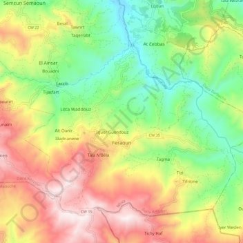
Name: Feraoun topographic map, elevation, terrain.
Location: Feraoun, Amizour District, Bejaia, 06330, Algeria (36.53164 4.82203 36.59968 4.93091)
Average elevation: 1,706 ft
Minimum elevation: 318 ft
Maximum elevation: 3,461 ft
Thank you for supporting this site ❤️
Make a donation
Make a donation
Gear up for your next adventure:
As an Amazon Associate, this site earns from qualifying purchases at no extra cost to you.