Geolocate

Litein topographic map

Click on the map to display elevation.

About this map

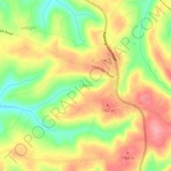
Name: Litein topographic map, elevation, terrain.

Location: Litein, Kericho, Kenya (-0.60330 35.16330 -0.56330 35.20330)

Average elevation: 6,312 ft

Minimum elevation: 6,112 ft

Maximum elevation: 6,476 ft

Gear up for your next adventure:

🪶Trail Camera - Capture wildlife on your hikes
🏔️Mountain Trail Maps - High‑detail maps for popular peaks
🪶LED Camping Lantern - Bright lantern for camp lighting
🧥Waterproof Jacket for Hiking - Breathable and rugged rain jacket for outdoor excursions
🎒Gear Packing Cubes - Organize your backpack efficiently

As an Amazon Associate, this site earns from qualifying purchases at no extra cost to you.