Geolocate

Mabank topographic map

Click on the map to display elevation.

About this map

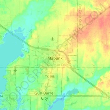
Name: Mabank topographic map, elevation, terrain.

Location: Mabank, Kaufman County, Texas, United States (32.33777 -96.17687 32.40127 -96.05347)

Average elevation: 374 ft

Minimum elevation: 312 ft

Maximum elevation: 463 ft

Kaufman County trails, hiking, mountain biking, running and outdoor activities

Other topographic maps

Click on a map to view its topography, its elevation and its terrain.

Gastonia

United States > Texas > Kaufman County > Gastonia

Average elevation: 440 ft

Gear up for your next adventure:

🪶Wildlife Field Guides - Learn animal tracking and species ID
🕶️Glacier Sunglasses - Side shields to protect eyes from high-altitude snow glare
🪶Survival Guide Book - Expert advice for emergency preparedness
🔦Powerful Headlamps - Ultra-bright hands-free lighting for night navigation
🗺️Topographic Maps - Detailed topo maps for hiking, exploring and outdoor navigation

As an Amazon Associate, this site earns from qualifying purchases at no extra cost to you.